



Crawler ES5XFM Floating LiDAR Robotic CCTV Inspection System
USD $47,000
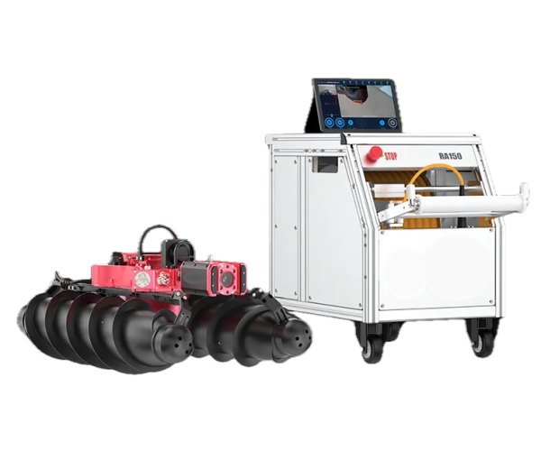
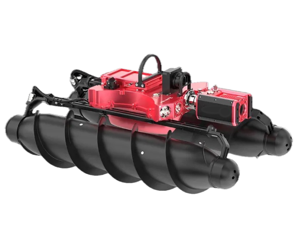
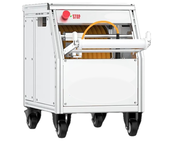
Maximize your pipeline assessment capabilities with the Crawler ES5XFM Floating LiDAR Robotic Inspection System. This industrial-grade pipe inspection robot is engineered for professional evaluation and advanced diagnostics of hard-to-reach engineering utility networks. The complete inspection complex features three main components: an amphibious crawler with a helical screw propulsion system (screw-drive vehicle), an automatic heavy-duty cable reel, and an intuitive control console terminal.
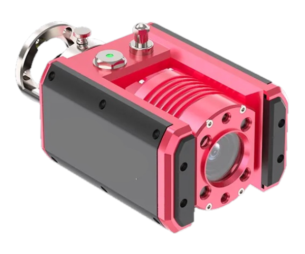
Designed specifically to operate in mainline pipelines with a minimum diameter of 23.6 in (600 mm), the ES5XFM excels in extreme environments with heavy silting, thick mud, and high water-filling levels where conventional wheeled robots fail. Equipped with a high-definition, 360° pan-and-tilt pipeline camera, this system ensures complete visual monitoring of utility infrastructure interiors. It is the ultimate solution for video diagnostics and inspection of municipal drainage pipelines, rectangular box culverts, enclosed storm channels, trunk sewers, and riverbeds.
Patented Amphibious Screw-Drive Performance
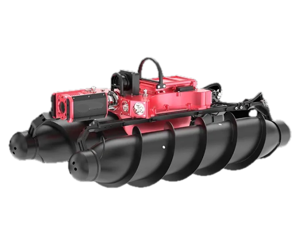
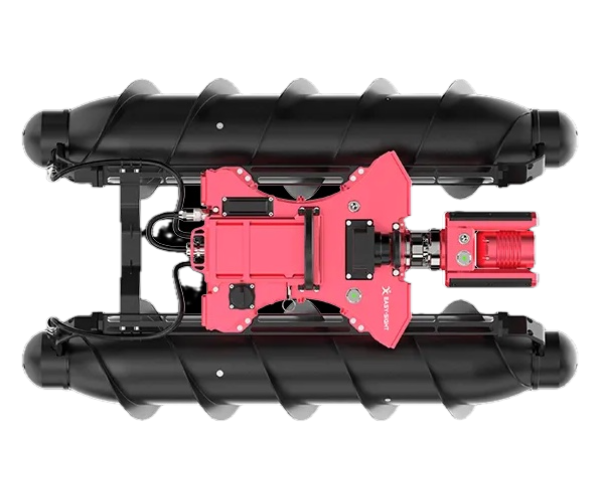
The ES5XFM floating robot crawler features a patented floating drum design, allowing it to navigate challenging hydraulic and hydrotechnical conditions effortlessly. Whether operating in deep water, thick silt, or highly turbid conditions, the robot delivers reliable traction. The device reaches transit speeds of up to 1.64 ft/s (0.5 m/s) in stagnant water and effectively conducts upstream pipe inspections against active currents with a flow velocity of up to 0.66 ft/s (0.2 m/s).
3D Laser Profiling, Sonar, and LiDAR Integration
Beyond high-precision video recording in water-filled pipes, this advanced platform supports multi-sensor integration for comprehensive pipeline asset management. Operators can connect a profiling sonar and a laser scanner (LiDAR) to enable:
- 3D Data Visualization: Generate precise digital twins of underground infrastructure.
- Laser Profiling: Run detailed assessments of pipe crown geometry and structural deformations.
- Sediment Analysis: Quantify underwater sediment deposits and silt buildup accuracy.
- Spatial Positioning: Map the exact geospatial coordinates of the utility network.
Thanks to its ultra-reinforced tether cable, the complex performs continuous, single-pass surveys over long distances of up to 6,725.7 ft (2,050 meters), providing unmatched scale for municipal and industrial monitoring projects.
Specifications
Specifications
Control Unit
-
Monitortablet or laptop
-
File ManagerAndroid/Windows
-
Recordingyes
-
Image Capturingyes
-
Remote Control Functionscrawler motion control (forward, backward, left, right), camera rotation control, movement speed control, light intensity control
-
Meter Counteryes
-
Camera Controljoystick
-
Keyboardyes
-
Power110V/60Hz lithium battery power supply, dimensions 352x187x260 mm, weight 10.2 kg.
-
Batterycharging time 2-3 h, operating time ≈8 h, battery capacity 1,028 Wh, charging temperature 0℃~45℃, operating temperature -20℃~60℃.
-
Operating Temperature14ºF 122ºF/-10ºC +50ºC
-
Storage Temperature14ºF 122ºF/-10ºC +50ºC
-
Humidity95%
-
Zoomoptical x10, digitalx12
-
Inclinometeryes
Camera Head
-
Camera Headpan-and-tilt camera 4.13 in * 3.46 in (105 mm * 88 mm)
-
Camera Lengthpan-and-tilt camera6/7"/171 mmrear view cameran/a
-
Direction of Viewpan-and-tilt camerapan 360°, tilt 180°rear view camera0º
-
Resolutionpan-and-tilt camera1/3" color CMOS, 2 MP (1920 * 1080), sensitivity 0.03 Luxrear view camera1/3" color CMOS, 2 MP (1920 * 1080), sensitivity 0.03 Lux
-
Field of Viewpan-and-tilt camera70ºrear view camera70º
-
Focal Rangepan-and-tilt camerafrom 2"/5 cm to 16/4ft/5 m, 10x optical zoom, 12x digital zoomrear view camerafrom 2"/5 cm to 16/4ft/5 m, 10x optical zoom, 12x digital zoom
-
Sonde8 KHZ
-
Protective Lenshigh-strength tempered glass
-
Lightingpan-and-tilt camera4 x 3W LED lightsrear view camera2 x 3W LED lights
-
WaterproofIP68, waterproof up to 10 meters, built-in pressure sensor with indicator
-
Camera Materialpan-and-tilt cameracomposite metal housingrear view cameracomposite metal housing
-
Camera Weightpan-and-tilt camera4.2lb/1.9 kgrear view cameran/a
Cable & Reel
-
Cable Lengthfrom 492.1 ft (150 meters) to 6,561.7 ft (2,000 meters)
-
Cable Diameter0.31 in (7.8 mm)
-
Cable Core materialflexible copper-core cable
-
Cable Cover/Braid Materialpolyurethane
-
Reel Materialstainless steel
-
Footage Counteryes
-
WaterproofIP68 cable, IP65 reel
-
Motorized Winchyes
-
Cable Auto Coilingyes
-
Reel Wheels4
-
Reel Stopperyes
-
Reel Dimensions22.44 in * 15.55 in * 18.70 in (570 mm * 395 mm * 475 mm)
-
Reel Weight113.5 lbs (51.5 kg) with a 492.1 ft (150 meters) cable.
Tractor
-
Tractor’s Speed1.64 feet per minute (0.5 meters per minute) in still water, 0.66 feet per minute (0.2 meters per minute) against the current
-
Engine Quantity2
-
Engine’s Power90 Watt
-
Fisheye Сamerano
-
LidarApplicable pipe diameters: three laser models for diameters of 9.84–14.17 in (250–360 mm), 12.60–47.24 in (320–1,200 mm), and 14.17–59.06 in (360–1,500 mm); imaging system: 1/1.8" CMOS sensor, 2 MP, 180°×180° field of view; lighting: 8W power with smooth brightness adjustment; LiDAR laser accuracy: ±0.04 in (±1 mm); protection rating: IP67; operating temperature: 14 °F to 131 °F (-10 °C to 55 °C); weight: 4.41 lbs (2 kg)
Reviews: 0
There are no reviews for this product.
Equipment Advice & Quotes
Ask a question or tell us what you need to inspect. We’ll help with equipment selection and pricing.